File:Da-ming-hun-yi-tu.jpg

From RationalWiki
Jump to navigation Jump to search

Original file(895 × 786 pixels, file size: 493 KB, MIME type: image/jpeg)

This file is from Wikimedia Commons and may be used by other projects. The description on its file description page there is shown below.

Summary

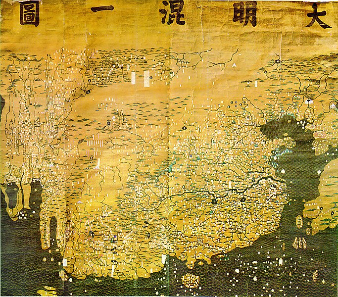
Description The Composite Map of the Ming Empire (Da Ming Hunyi Tu) reflects the political situation in AD 1389 but was likely painted much later. Original Chinese labels were later covered with Manchu on paper slips.
Date after 1389
date QS:P,+1389-00-00T00:00:00Z/7,P1319,+1389-00-00T00:00:00Z/9
Source http://geog.hkbu.edu.hk/GEOG1150/Chinese/Catalog/am31_map1.htm
Author Chinese (image enhanced by contributor)

Licensing

This is a faithful photographic reproduction of a two-dimensional, public domain work of art. The work of art itself is in the public domain for the following reason:
Public domain

This work is in the public domain in its country of origin and other countries and areas where the copyright term is the author's life plus 100 years or fewer.


You must also include a United States public domain tag to indicate why this work is in the public domain in the United States.
This file has been identified as being free of known restrictions under copyright law, including all related and neighboring rights.
The official position taken by the Wikimedia Foundation is that "faithful reproductions of two-dimensional public domain works of art are public domain".
This photographic reproduction is therefore also considered to be in the public domain in the United States. In other jurisdictions, re-use of this content may be restricted; see Reuse of PD-Art photographs for details.

Captions

Add a one-line explanation of what this file represents

Items portrayed in this file

depicts

image/jpeg

6c12193a6cf9b752305654d9fbaca204108740fd

505,219 byte

786 pixel

895 pixel

File history

Click on a date/time to view the file as it appeared at that time.

Date/TimeThumbnailDimensionsUserComment
current01:14, 17 March 2008Thumbnail for version as of 01:14, 17 March 2008895 × 786 (493 KB)David Trochos{{Information |Description=The Da Ming Hun Yi Tu (Great Ming Dynasty Amalagamated Map), painted on silk in AD 1389 but with Manchu language captions superimposed on paper slips several centuries later, is the oldest surviving Chinese world map. |Source= h

The following page uses this file: