File:2015 UK general election constituency map.svg

From RationalWiki
Jump to navigation Jump to search

Original file(SVG file, nominally 1,477 × 1,925 pixels, file size: 98 KB)

This file is from Wikimedia Commons and may be used by other projects. The description on its file description page there is shown below.

Legend

 
Alliance Party (Northern Ireland)
 
Undeclared/Delayed
 
Regional boundaries

Summary

Description
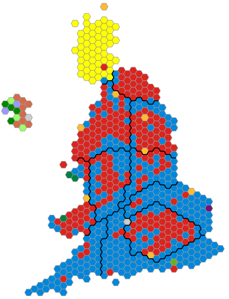
English: An alternative map showing the results of the 2015 UK General Election showing constituencies as equal area hexagons and approximate geographic location.
Date
Source Self made, based upon previous version
Author Ch1902

Licensing

Public domain I, the copyright holder of this work, release this work into the public domain. This applies worldwide.
In some countries this may not be legally possible; if so:
I grant anyone the right to use this work for any purpose, without any conditions, unless such conditions are required by law.

Captions

Add a one-line explanation of what this file represents

Items portrayed in this file

depicts

8 May 2015

image/svg+xml

635df31200e7eed2e66131a91db73933fe6de682

100,398 byte

1,925 pixel

1,477 pixel

File history

Click on a date/time to view the file as it appeared at that time.

Date/TimeThumbnailDimensionsUserComment
current19:29, 8 May 2015Thumbnail for version as of 19:29, 8 May 20151,477 × 1,925 (98 KB)Ch1902Fix style sheet & class names

The following page uses this file:

Metadata